
Historic Site Nagae Sakurayama Tumulus Cluster

Historic Site Nagae Sakurayama Tumulus Cluster
Designated on December 19, 2002 (Heisei 14)
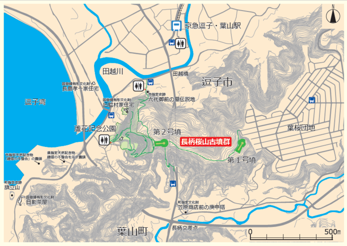
The Nagae Sakurayama burial mounds were newly discovered in March 11 (1999) on a hill on the border between ZushiCity and Hayama This is a keyhole-shaped tumuli from the early Kofun period (the latter half of the fourth century) and are among the largest existing tumuli in Kanagawa Prefecture.
(Courtesy of Kanagawa Prefectural Board of Education)
Tumulus No. 1
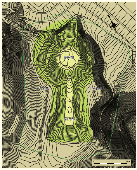
Total Length 91.3 m, Back Circular Diameter 52.4 m, Constriction Width 24.2 m, Back Circular Height 7.8 m
The existence of the tumulus became known for the first time as Hayama-cho resident Yonosuke Towno(東家洋之助)discovered the haniwa during construction to build a mobile phone base station on the mountain top.
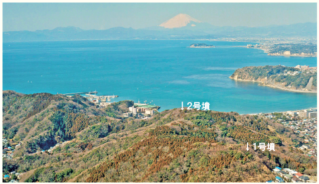
It was built on a hill 120 meters above sea level, and 1 burial facility (clay cave) was found in the back circular part, surrounded by cylindrical haniwa (clay tablets). In addition, bottle-shaped haniwa and earthenware believed to have been used for funerals were also found. It is now covered in trees, making it difficult to see, but the top of the mound offers views of Sagami Bay to the west and Tokyo Bay and the Boso Peninsula to the east.
Tumulus No. 2

Total Length: Approx. 88 m, Rear Circular Diameter: Approx. 54 m, Constriction Width: Approx. 32 m, Rear Circular Height: Approx. 8 m
The existence of the first tomb was confirmed soon after the discovery. It is built on a hill at an elevation of 100 meters, about 500 meters west of the No. 1 tumulus,and has a panoramic view of Sagami Bay on the west side of the front. It is not known in detail because the excavation has not been carried out in detail, but there is not much difference in height between the back circular part and the front square part,and the front square part is wider than the No. 1 tumulus. The surface of the tumulus was covered with stones (fukiishi), and cylindrical and pot shaped haniwa similar to the first tumulus have been found.
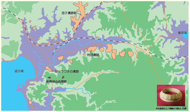
The base of the Miura Peninsula, where the burial mounds are located, is slightly narrow and connects Sagami Bay and Tokyo Bay by land in the shortest distance of about 5.3 km. It is not known exactly who was buried, but it is believed that the tomb of a powerful person who controlled the traffic connecting the two bays, and that the site where the burial mounds were built was a key traffic point on the Pacific coast between the Tohoku, Kanto and Kinai regions at that time.
このページに関するお問い合わせ
教育部社会教育課文化財保護係
〒249-8686 神奈川県逗子市逗子5丁目2番16号
電話番号:046-872-8153
お問い合わせは専用フォームをご利用ください。